Aeroscope, detecting and controlling the actions of DJI drones
Modern commercial unmanned aerial vehicles (UAVs) can approach a target object at a speed of 20-40 m/s. At the same time, a person hears noise from them on average at a distance of less than 400 m in rural areas and 100-150 m in the city. The response time in this case is from 3 to 20 s. For an unprepared person, for example, a security officer who does not have the appropriate monitoring tools, this is an extremely short time.
It is obvious that the use of detection tools in conditions of a high speed of development of the situation makes it possible to detect and identify elements of an unmanned aerial system (UAS) in advance.
There are various ways to detect drones and elements of their systems. The drone and the pilot controlling it can be detected with the simplest radar equipment. The fact is that the ground control station (RC remote control) and the unmanned aerial vehicle are constantly exchanging data with each other. It is so important that disruption of the data exchange process for just 3 seconds in DJI drones leads to the automatic implementation of the scenario of actions in case of loss of communication between UAS elements: flight mission interruption, automatic return to the take-off point (Go Home), hovering or landing, depending on the selected settings pilot.
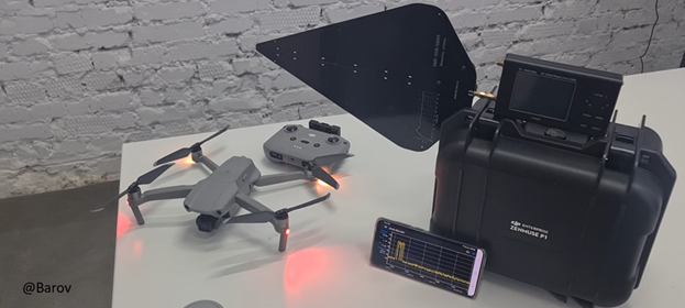
Spectrum analyzer.
Allows you to determine the azimuth to the elements of the UAS by the signal level of the spectral components, at a distance of up to 5 kilometers with an accuracy of 7 degrees.
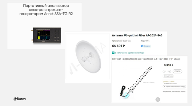
The device and antennas for it are commercially available.
Aeroscope.
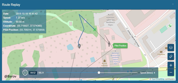
The detection device from the DJI drone manufacturer identifies most of the DJI drones flying in our country. In addition to signaling the presence of UAS elements in the monitoring area, it is able to accurately determine its serial number, display elements on a satellite map with the ability to scale and record characteristics, flight trajectory, aircraft coordinates throughout the flight, takeoff point (Home Point) and location coordinates location of the operator (Pilot Position).
Using Aeroscope, you can get the planned coordinates of objects through which the UAV flight path passes in real time, taking as a basis the displayed coordinates of the drone located above these objects. It is also possible to get the coordinates later from the flight log stored in the Aeroscope by playing the track of interest.
In this case, the tool for determining the geoposition of objects is GNSS, the successor to the unmanned aircraft, which reports Aeroscope data through the decoding of the data exchange channel with the RC control panel.
If it is necessary to obtain altitude data about objects along the flight trajectory, it is possible to calculate them, taking as a basis the data displayed by the device on the UAV flight altitude. The data obtained in this way will be indicative.
Until recently, Aeroscope was produced in two versions: stationary (left) and portable (right).
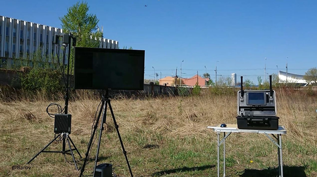
Portable Aeroscope.
Allows you to detect elements of the DJI unmanned aerial system within a radius of up to 5 km. The portable version is able to work autonomously and requires the physical presence of the operator. Due to the localization of all processes inside a small portable unit, it is often integrated into anti-UAS systems.

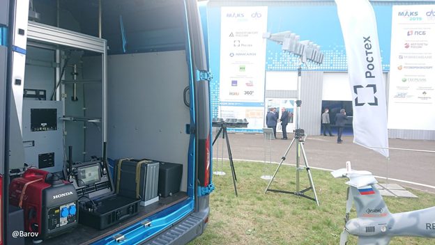
Despite high demand, DJI has discontinued the handheld version. Currently, only a stationary version is produced and sold, requiring an Internet connection and 220 volt power.
Stationary Aeroscope.
Allows you to detect UAS within a radius of up to 30-35 km, consists of a radio receiver and a back end server. Such devices can be mounted on vehicles, often installed on the territory of facilities that require control over the use of airspace by unmanned aerial vehicles.
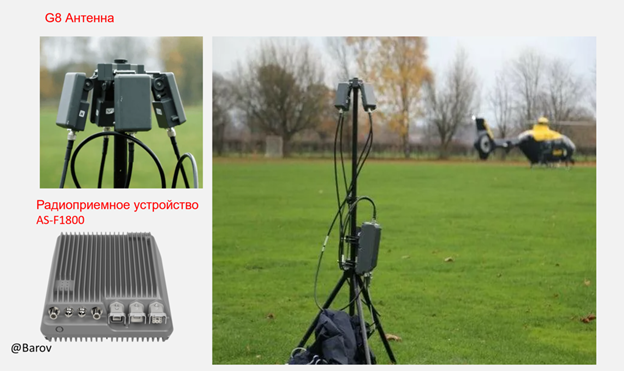
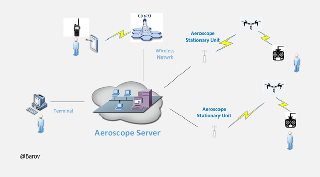
In this version, the Aeroscope operator accesses its server via an interface from anywhere in the world, it can serve a whole network of receiving modules, Aeroscope antennas and transmit data to interested parties about the actions of the UAV and the location of the ground control station (RC console).

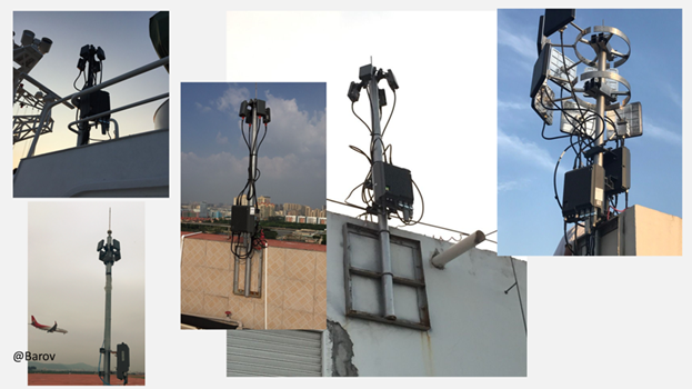
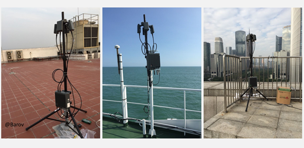
The detection range of Aeroscope depends, first of all, on the openness of the terrain at the installation site, the level of interference in the monitoring area, the degree of signal amplification (omnidirectional antenna = 0dB, G8 = 8dB), antenna directivity, type of data transfer protocol (OCUSYNC, LB, WiFi) used by an unmanned aircraft.
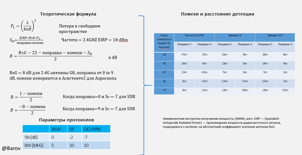
Another important factor affecting the detection range is the distance between the UAV and the ground control station (RC). The fact is that DJI uses an adaptive system for adjusting the power of its transmitters, raising it as the elements of the unmanned aerial system move away from each other.


